

The East Sea is geographically located northeast of the Asian Continent and west of the Pacific Ocean, surrounded by the Maritime Province of Sakhalin Island in Russia and the Japanese Islands. The East Sea was also called, “Sea of Korea” and “Sea of Chosun,” bordering Tatar Strait to its north and the Korea Strait to its south.
It is said that the East Sea was created about 30 million years ago in the early quaternary period of the Cenozoic Era. There are two theories on the cause of its formation; the ingression sea theory where what was once a continent became a sea and the continental drift theory where the Japanese Islands, originally attached to the continent, moved east and formed a sea.
The East Sea originated about 30 million years ago in the early quaternary period of the Cenozoic Era. There are two theories on the cause of its formation. One being the coastal ingression theory which explains that continent became deluged and parts of it became sea and the other being the continental drift theory where the Japanese Islands, originally part of a continent drifted apart, moved east and formed a sea.
The East Sea forms an elliptical shape along the northeast-southwest apse line. It is 1,700 kilometers long from north to south, maximum 1,100 kilometers wide from east to west, and 1,361 meters deep on average. In particular, the area near the Maritime Province of Russia and the Korean Peninsula is known to be deeper, forming a downward slope of about 3,000 meters. The deepest part is on the northeast region near the Ogiri Island and 3,762 meters deep, and its area is estimated to be 1.361 million cubic kilometers. Coastal areas around Korea Sea is on average is around 200 meters in depth and cover the total landmass of 280,000 square kilometers. Recent surveys indicate that the total area which is 3000 meter deep or more adds up to total of 300,000 square kilometers.
In 1920s, the first modern Korean oceanographic survey was conducted to benefit the fisheries. After World War II, additional observations and research were conducted by National Fisheries Research and Development which yielded sizeable amount of oceanographic and scientific knowledge surrounding East Sea or Sea of Korea. Improvement in observational techniques surrounding the East Sea allowed for vast amounts of data to be produced and compiled. More recently, neighboring states have also cooperated in oceanographic research to further the knowledge about the East Sea.
In recent times, Atlas of East Sea was compiled by integrating various oceanographic data from the southwestern region of the East Sea, coupled with interdisciplinary observational programs carried out between 1994-1997 conducted by KORDI. Also, 35 years plus years collected by NFRDI were also incorporated in the data analysis.
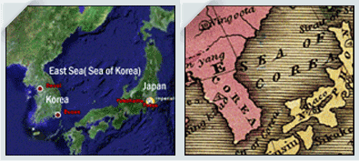 19th – Map Sea of Korea (East Sea)


Recent Comments